

China Maps and Books
If you are interested in doing your own route planning, or wish to tour on your own, you may find these references useful.
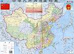
.jpg) China Road Atlas
– Good resource for both planning and on-the-road use. Shows virtually
every through road in China outside of the cities and provides distances
between most links. Relatively little topographic information, but does
show railroad, rivers and some mountain peaks. Detailed maps are provided
for 68 of the largest cities. 374 pages.
China Road Atlas
– Good resource for both planning and on-the-road use. Shows virtually
every through road in China outside of the cities and provides distances
between most links. Relatively little topographic information, but does
show railroad, rivers and some mountain peaks. Detailed maps are provided
for 68 of the largest cities. 374 pages.
Covers entire China
 China Provincial Maps
- Large scale one-sided maps generally about 0.75 m X 1 m and showing entire
provinces and edges of abutting provinces. Hebei province surrounds
Beijing so is a good overview of the Beijing and Great Wall in that area.
Maps are completely in Chinese. Use with the English-Chinese
bilingual map in you cannot read Chinese.
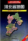
China Provincial Maps
- Large scale one-sided maps generally about 0.75 m X 1 m and showing entire
provinces and edges of abutting provinces. Hebei province surrounds
Beijing so is a good overview of the Beijing and Great Wall in that area.
Maps are completely in Chinese. Use with the English-Chinese
bilingual map in you cannot read Chinese.
 China Provincial Atlas
- Very detailed road atlas usually about 30 pages in length and includes
distance charts between cities as well as detailed city maps. Maps are completely
in Chinese. Use with the English-Chinese bilingual map in you cannot read Chinese.
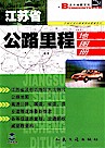
China Provincial Atlas
- Very detailed road atlas usually about 30 pages in length and includes
distance charts between cities as well as detailed city maps. Maps are completely
in Chinese. Use with the English-Chinese bilingual map in you cannot read Chinese.
 Beijing, Shanghai and Guangzhou
City Maps - Large scale detailed maps of the major cities in China.
Use with the English-Chinese bilingual map in you cannot read Chinese.
Beijing, Shanghai and Guangzhou
City Maps - Large scale detailed maps of the major cities in China.
Use with the English-Chinese bilingual map in you cannot read Chinese.
 English Chinese China Map –
Provides names of locations in both English (pinying) and Chinese characters.
Useful if you can't read Chinese for reading maps with only Chinese characters.
English Chinese China Map –
Provides names of locations in both English (pinying) and Chinese characters.
Useful if you can't read Chinese for reading maps with only Chinese characters.
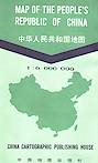
| Scale | Scale in Kilometers Miles | Physcial Size |
| 1:4,500,000 | 45 km/cm or 112 miles/inch | 1.0 X 1.3 m (3.06 X 4.37 ft) |
| 1:6,000,000 | 60 km/cm or 150 miles/inch | 0.76 X 1.00 m (2.38 X 3.28 ft) |
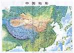 Small Topograghic and Road Maps of China - This
is a two sided map. One side shows the Topographic map of China with place
names in Chinese. Scale of 1:12,700,000 which translates to 127 kilometers
per centimeter or 200 miles per inch. The other side shows the Road and
Railroad map of China with place names in Chinese. Scale of 1:12,000,000
which translates to 120 kilometers per centimeter or 185 miles per inch.
Measures 0.52 x 0.38 meters (1.7 x 1.25 feet).
Small Topograghic and Road Maps of China - This
is a two sided map. One side shows the Topographic map of China with place
names in Chinese. Scale of 1:12,700,000 which translates to 127 kilometers
per centimeter or 200 miles per inch. The other side shows the Road and
Railroad map of China with place names in Chinese. Scale of 1:12,000,000
which translates to 120 kilometers per centimeter or 185 miles per inch.
Measures 0.52 x 0.38 meters (1.7 x 1.25 feet).
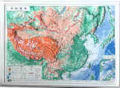 3D-Map of China - This is a plastic three-dimensional map of China
with place names in Chinese. Scale is 1:40,000,000. Measures 22 cm X 30
cm (8.6 inches X 11.8 inches)
3D-Map of China - This is a plastic three-dimensional map of China
with place names in Chinese. Scale is 1:40,000,000. Measures 22 cm X 30
cm (8.6 inches X 11.8 inches)
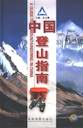 A Guide to Mountaineering in China - Book measures
15 x 22 x 2 cm (6.25 x 8.7 x 8.8 inches) with 222 pages and is published
by the Chengdu Cartographic Publishing House. Written in both English
and Chinese this book includes includes a contour maps, a sketches of possible
climbing routes, a road location maps for several mountains and descriptions
of 44 mountain areas in Sichuan, Qinghai, Tibet, Yunnan and Xinjiang.
A Guide to Mountaineering in China - Book measures
15 x 22 x 2 cm (6.25 x 8.7 x 8.8 inches) with 222 pages and is published
by the Chengdu Cartographic Publishing House. Written in both English
and Chinese this book includes includes a contour maps, a sketches of possible
climbing routes, a road location maps for several mountains and descriptions
of 44 mountain areas in Sichuan, Qinghai, Tibet, Yunnan and Xinjiang.
![]() Concise
Chinese/English - English/Chinese Dictionary - Compact book measuring
4.2 x 16 x 8 cm (1.7 x 6.2 x 3.1 inches) but with 1,463 pages published
by the Oxford University Press. Also available in German, French and
Japanese.
Concise
Chinese/English - English/Chinese Dictionary - Compact book measuring
4.2 x 16 x 8 cm (1.7 x 6.2 x 3.1 inches) but with 1,463 pages published
by the Oxford University Press. Also available in German, French and
Japanese.
Order Options
| Check/Money Order |
Bike China Adventures, Inc.
Home | Guided Bike Tours | Testimonials |
| Photos | Bicycle Travelogues
| Products | Info |
Contact Us
Copyright © Bike China Adventures, Inc., 1998-2017. All rights reserved.